


Suunto-blogg


On the rise: top stories from World Vertical Week 2020
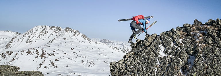
© Philipp Reiter
World Vertical Week has become an annual tradition, and many Suunto users are finding creative ways to get the most out of it.
The week is really an invitation to get outside, to push oneself, and find new resolve and strength. It’s also a chance to show that nearby hill or mountain who’s boss.
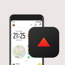
This year, we again ran a World Vertical Week photo competition with three lucky people winning a Suunto 7 or a Suunto 9. We asked our Instagram followers to share an image with a Suunto app data overlay from one of their ascents over the week and tag #verticalweek. We received so many inspiring entries. Thanks to everyone who participated. Check out the winners and their shots below. Congrats!
Firemen to the rescue!
Two firemen in Finland went above and beyond the call of duty for World Vertical Week. Henri-Aleksi Pietilainen, 29, and his room mate at the Rescue Academy showed their dedication by donning their protective fire gear and ascended the most popular training hill in Helsinki multiple times – and just after finishing a 24 hour shift. Respect guys!
“We thought it was going to be easier (considering my level of training in the mountains and my friend’s latest expedition through Greenland), but the extra 25 kg of weight and unforgettable clothing and gear gave a nice extra ‘touch’ and was really good training,” Henri says. “We did this in a pair because in real firefighting rescue missions it’s good to have a partner to help each other out.”
Cooking up a storm
It was Lukasz Bodaszewski’s first time participating in World Vertical Week. The 39-year old chef from Poland runs a catering company with his wife in the French Alps. He aimed to ascend 3000 m over the week, and managed 2300
“But I finished 1000 m in one day and I’m proud of that,” he says. “Vertical Week was good timing because I’m training for the 160 km Val d’Aran UTMB in the Pyrenees and for 145 km TDS at UTMB this year, so it was good to have a specific climbing week.”
Getting out there
Casey Sackett didn’t hold back for World Vertical Week. From Hurricane, Utah, Casey aimed to achieve a mile of vertical gain (1610 m) over the week. He notched up a total of 1631 over a series of awesome trips, including mountain biking the Gooseberry Mesa and the rest what he refers to as “desert alpinism” (alpine style lines in a desert ecosystem).
“Conditions were perfect all week out here and gave me the opportunity to get out every chance I had!” Casey says. “My favorite push was my last one, trekking/trail running up a mesa to the La Verkin Overlook. My eight-year-old daughter set the pace on the 4 km ascent with almost 243 m of gain. We did it in just 61 minutes! Her endurance blew me away, so proud!”
Thanks again to everyone who got out there and pushed their comfortzone for World Vertical Week. Keep it up!
Lead images: © Philipp Reiter
Read more articles
The nation that climbed the most in World Vertical Week is ...
7 tips to accelerating your vertical speed
How to find your way in the mountains

Raising the stakes for Suunto World Vertical Week
© Philipp Reiter
For us mere mortals, the Hoch Tirol ski route in the Austrian Alps usually takes six days of gut busting effort and every ounce of our endurance.
German ski mountaineer and trail runner Philipp Reiter and fellow runner and ski mountaineer Frenchman Francois D'haene aim to cover the 100 km and 10,000 m vertical gain in 24 hours starting this coming Monday. Both men enjoy a challenge.
“There’s a saying that it’s well known that something isn’t possible, and then someone comes along and just does it,” Philipp says. “You set a new limit and show that something once considered impossible is possible.”
To Philipp, this is what Suunto World Vertical Week is all about; taking on personal challenges. “For myself, when I have overcome a challenge like this, and I have other challenges not connected to sports, I understand if I just keep taking steps towards the goal I’ll eventually reach it.”
You can follow their adventure live and enjoy the beauty of the Austrian Alps; Philipp and Francois will be posting shots live from their adventure to our Instagram feed.
Click to find out about the Suunto World Vertical Week 2020 photo contest!
© Philipp Reiter
When Philipp isn’t out training in the hills, he works as a photographer for Salomon, capturing the action at big races in Europe. Over the last few years Francois noticed that he won all of the races when Philipp was at them working. “Eventually we decided to do something together, which is quite nice,” Philipp says.
Considered the queen of all ski routes, the Hoch Tirol route begins in Kasern in South Tyrol, and traverses Austria’s fourth highest mountain, Großvenediger (3657 m), and ultimately ends on the summit of the nation’s highest mountain, Großglockner (3798 m).
Philipp and Francois will start their journey around 9am on February 24, pushing hard to cover as much ground as possible before night falls and the going gets tougher. “The second stage will be the toughest,” Philipp says. “Navigation will be a challenge. It will be cold and we will be tired.”
Follow Philipp and Francois's adventure live here.
Lead images: © Philipp Reiter
Read more articles
This challenge will take you higher!
Must run routes around the globe!
Which nation runs the fastest? 10 fun facts from 2019.

This challenge will take you higher!
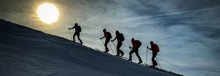
© Phillipp Reiter
Believe it or not, there’s a hill or mountain somewhere that’s looking down at you laughing. It believes you’re a weakling. Do you have what it takes to shut it up?
That’s what Suunto’s annual World Vertical Week is about for the thousands of fans who participate each year. They find a nearby range, hill, or mountain that’s looking at them disrespectfully, and show that large mass of rock and earth who’s boss. As Sir Edmund Hillary famously suggested, there’s something satisfying about knocking the bastard off.
Seriously though, World Vertical Week is about the joy of a challenge, of sweating like a beast, and overcoming one’s resistance to fighting gravity to reach a summit. It’s an inexplicable human urge. All we know is we feel incredible after. To make it even more fun, we give you three incentives below to participate!
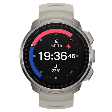
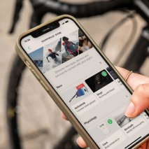
To participate in Suunto World Vertical Week 2020, open Suunto app and click the Vertical Week link in your inbox (the bell symbol on the top of your screen takes you to your inbox).
© Phillipp Reiter
New decade, new challenge
Starting on Sunday, February 23 and ending Sunday, March 1, this fifth edition of Suunto World Vertical Week also marks the first of a new decade. That’s why we want it to be the best ever.
For this reason we are sending out two special, optional challenges: climb 1000 m of vertical in one day during the week. Or, if that’s not possible, climb 1000 m over the whole week. That’s only a puny 150 m a day! Just imagine that arrogant hill sniggering if you fail!
Be in to win a Suunto watch
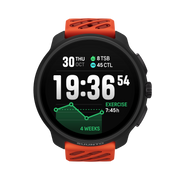
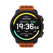
To give you extra incentive, we are running a photo contest on Instagram over the week, and will give away a Suunto 7 smartwatch or a Suunto 9 to three of the most inspiring photos that enter. All you need to do is share an image with a Suunto app data overlay and tag #verticalweek. We will decide the winners at the end of the week!
Click here to learn how to share your activities with Suunto app.
(Terms and conditions apply. Check them here.)
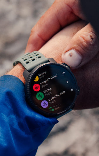
Rep your nation and sport
You can join the challenge on Suunto app, log all your efforts, and also compete for your nation and activity type. Last year, Italy came out on top for average ascents during the week. Spain also kicked ass; it came first in three divisions, and was also in the top five for four different activities. Will they continue to dominate?
To kickstart your competitive spirit, click here to see the results of last year’s Suunto World Vertical Week!
Lead images: © Phillipp Reiter
Read more articles!
Raising the stakes for Suunto World Vertical Week
7 tips to plan a route in the mountains
Which nation runs the fastest? 10 fun facts from 2019
10 ways to make your adventures more sustainable
How to find your way in the mountains.

7 tips to plan a route in the mountains
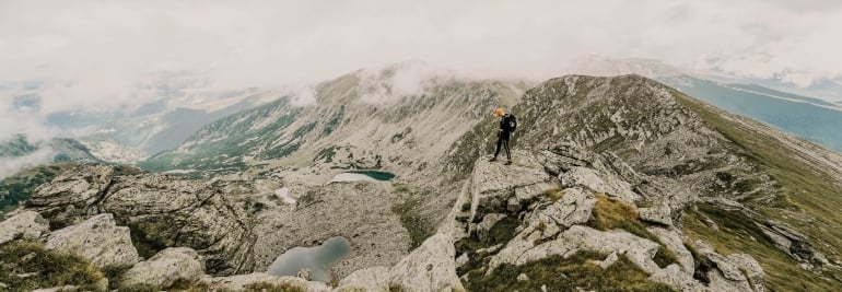
The better prepared you are the more likely the trip is a success. © Arc'teryx / Piotr Drozdz
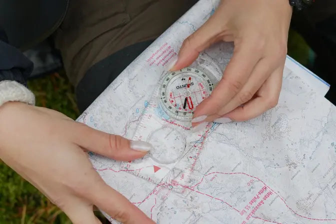
While deep in the mountains you are on your own. Take a wrong turn and you might be waiting awhile for the cavalry to arrive. That’s why respect is so important, and one shows that respect for mountain terrain by preparing well.
In the first article in this series on how to navigate in the mountains, we looked at map reading and location awareness. In this second post, our resident navigator-in-chief Terho Lahtinen takes us through the steps of planning a route.
Start somewhere familiar
For the purposes of practice, consider starting somewhere you are familiar with. That way you won’t be afraid of getting lost and will have more confidence to navigate by map and compass. “Another attribute of a good training terrain is it offers enough features to study on the map and in the terrain,” Terho says.
Choose your destination
This seems obvious, right? But it’s important to be clear about this and not have a vague idea. “Choose an area, a specific destination, some other target to visit,” Terho says. “Then consider how much time you have available and what kind of distance you can cover within that time.”
Be realistic
Don’t bite off more than you can chew. Consider the fitness and skill level of your group, and make sure you factor that into your planning. It’s always good to be a little on the cautious side.
Explain your trip plans to the group so you are all on the same page. © Dean Leslie / Red Bull Content Pool
Study the map
Ok, you’ve chosen a destination and considered your group, now it’s time to channel your inner nerd by studying the topographical map of where you intend to go. Notice we said “topographical map”; no tourist maps allowed – they don’t offer enough detail. Here’s what to look at on your trusty topo map:
Terrain features: First get an overview. In mountain areas, it’s essential to recognize the ridges, valleys, passes, rivers and other big formations.
Trail difficulty: If you intend to follow trails, find out what level of difficulty they are. Trails are often rated as easy, medium and difficult, and marked with different dashes on the map depending on the rating.
Trip options: What are the options on the map? For example, is there an easier versus more difficult route? Is there more than one way in and out? Is there a route that offers more shelter? Is there an easier plan B if plan A turns out to be too challenging for the group?
Distance: Measure the distances between points. You can do this by knowing the scale of your map. Every 1 cm on a map in 1:25 000 scale represents 250 m of terrain. Every 1 cm on a map in 1:50 000 scale represents 500 m of terrain. The average walking pace on flat terrain is 4 km/h, and can halve in difficult or steep country. What distance is possible for your group? Remember, the slowest in the group sets the pace!
Ascent/descent: As we mentioned in the previous article, look at the contour lines on the map. Where do they stack together, indicating steepness, and where are they spaced further apart, indicating more level terrain?
Calculate the total ascent and descent sums to estimate how hard or easy certain routes would be. It’s advisable to calculate 300m/h for ascents and 500m/h for descents. Consider the time available and the fitness of your group, and choose a route that ensures you avoid pushing people too far beyond their comfort zone.
Technical difficulty: Look for areas that might prove challenging, such as exposed trails above the treeline, snow cover in shadowed places, ground covered in rocks or tree roots, steep ascents or descents, river crossings, dense forest, or narrow trail. To help understand, research the area online. Try to find trip reports people have written about the area.
Shelter: In the event the weather turns nasty where on your route can you find shelter? This might be natural or manmade shelter.
Water: For overnight or multi day trips, look for water sources on your map.
Accommodation: If it’s on overnight or multi day trip, look for where you will sleep. If you’re camping, find where you are allowed to pitch your tent. If you want to sleep in a mountain hut make sure there are enough beds available and book early.
Be generous with time
On longer day trips or overnight trips, remember to factor in breaks in your planning. “Breaks are not only for resting, they are for enjoying and observing nature, for relaxing and immersion,” Terho says. “They are an essential part of the experience.”
So make sure you are generous in affording break time. Terho recommends to plan a five to 10 minute break each hour, or 10 to 20% of your moving time.
Allow for delays
Take into account the potential for unplanned delays along the way. A sudden lightning storm, torrential rain, a snow-covered trail, a dangerously swollen river, or a flooded trail – there are many things that could slow you down.
“The bigger the group, the more delays there will be as people adjust their gear, change clothing, or have pee breaks,” Terho says. “Factor this in.”
Practice makes perfect
Time for your homework! Using a local topo map, plan a route at home by following the above, and then go out and test the plan in the terrain. When planning, pay attention to the details and terrain features on the map that you should look out for on the trip in order to know you’re staying on the right course. Make a game of trying to identify as many of these features as you can when following the route.
Keep track of time, the degree of difficulty, delays you encountered, and once you are back at home compare how the trip unfolded in comparison to how you envisioned it based on your planning. What was different? What took more time than expected? What was easier?
Stay tuned for the next article in the series: Staying on course in the mountains!
Lead images:
Photo by Toa Heftiba on Unsplash
© Dean Leslie / Red Bull Content Pool
Read more articles:
How to find your way in the mountains
7 tips to find a safe track up the mountain
8 avalanche safety checks to tick off before the ski season


How to walk your way to good health
Photo by Emma Simpson on Unsplash
Walking, like breathing, is so ordinary we take it for granted. Yet, it offers so much. Learning to appreciate walking can give us a new lease on life. We slow down, enjoy the moment and scenery, improve our health, take stock of our lives, and even increase our creativity. What’s not to like?
In this series of articles we will be exploring walking and all the reasons walking is so awesome. We’ll be looking at the benefits of walking regularly, walking technique and posture, how to walk mindfully, and we’ll be challenging you to walk more, including taking on a long distance trail.
Walking can be much more than just about getting from A to B. For many people, it’s a way of life. It can become a way to come back to what really matters.
The oldest form of exercise?
Our human ancestors, scientists say, began walking on two legs somewhere between three to six million years ago. Some theorize this happened because standing meant they could see further afield, allowing them to detect potential threats and food sources. Another study suggests bipedalism evolved because it’s more energy efficient than walking on all fours. Walking on two legs also freed our hands to use tools.
Whatever the reasons, humans have been walking for a very long time. We walked out of Africa, across Europe, Central Asia, into North America and down south. As a species, we are almost coded to explore and conquer new territory on foot. It’s what we do.
Photo by Aaron Burden on Unsplash
The best antidote
Walking is an excellent antidote to the busyness and constant connectivity of modern life. In our attention economy, where multiple devices and channels compete for our attention, knowing how to slow down and focus is an increasingly important skill.
Walking is the perfect way to cultivate this skill. It can be the time of the day we take to consciously slow down and pay attention. Rather than having our attention scattered, walking gathers it into a more singular focus. We all need to switch off. We all need to slow down. Walking for the sake of walking is a great way to do this.
The benefits of walking regularly
According to the Better Health Channel, Harvard Medical School, and others the benefits of walking include:
Increased cardiovascular and pulmonary (heart and lung) fitness
Reduced risk of heart disease and stroke
Improved management of conditions such as hypertension (high blood pressure), high cholesterol, joint and muscular pain or stiffness, and diabetes
Stronger bones and improved balance
Increased muscle strength and endurance
Reduced body fat
It counteracts the effects of weight-promoting genes
It helps tame a sweet tooth
It reduces the risk of developing breast cancer
It eases joint pain
It boosts immune function.
Building the walking habit
Building a habit takes time and consistency. It’s best to start by making the habit easily doable. To begin with, choose a distance to walk each day that you know you can manage.
Forget about the 10,000 steps hype – a study found that number came from a marketing campaign rather than scientific research – and instead choose a distance, time or step count that is achievable and encourages you to move.
Maybe walking 30 minutes a day works or taking 5000 steps is more realistic for you. You don’t need to do it all at once; you can break it down into chunks, for example walking 15 minutes bites. Once you’ve decided, adjust your activity goals accordingly in your Suunto 3.
Remember, every little bit counts, so look for opportunities to take extra steps. Stand up, and pace while your are on the phone, for example, or choose stairs instead of taking an escalator or elevator, have micro exercise breaks throughout your working day, and try having walking meetings. There are many opportunities to walk more – use your imagination!
In the next article we’ll discuss walking technique – stay tuned!
Lead image: Photo by Fabien Bazanegue on Unsplash
Must-run routes around the globe
One of the awesome things about visiting new cities is getting off the beaten tourist paths and finding hidden corners. An early morning run through an unknown city is one of the best ways to find these gems. There is so much beauty in the world when we have fresh eyes. So next time you travel to new destination, lace up your runners and get out and explore.
For inspiration, here are routes in seven of our favorite cities.
RUNNING IN SINGAPORE
If its your first time in Singapore, you will be pleasantly surprised at just how diverse the city’s running opportunities are. The city hosted more than 100 running events in 2015, from road marathons, trail races and vertical marathons to fun runs, with distances ranging from 5 km to 100 km. This tiny island-city also has plenty of parks and running trails that literally wrap around and connect the island together.Despite its small size, it has one of the most active populations in mass participation running events. Trails and paths along on the water and in the forest are well maintained, well-lit and safe, you’ll love running here, regardless of your route.
Read the article and see the routes >
RUNNING IN STOCKHOLM
This Nordic capital is a pretty fascinating place to visit, and to run. Made up of more than a dozen rugged islands, this city by the sea is both accessible and wild; a splendid combination for those of us wanting to explore her streets and shores by running! Amongst the meandering canals and shorelines, and urban forests, we’ve found some rather memorable runs that will give you a taste of this historic city, which has one of the oldest, and best-maintained city centres in Europe.
Read the article and see the routes >
RUNNING IN BARCELONA
One of the most memorable and hospitable cities to run in, Barcelona’s streets, parks and trails are as welcoming as her inhabitants. While Barcelona is the largest city on the Mediterranean Sea, it is also an intimate and intricate place with subtle beauty that seems to mix perfectly with its more audacious architecture. To see Gaudi’s masterpiece, the fantastical Sagrada Família in person is one thing, but to gain a sense of the city by running amongst her streets and people is something that won’t fail to leave a lasting impression.
Read the article and see the routes >
RUNNING IN PARIS
The City of Light could also be known as a runner’s delight! It is a feast for the senses, it’s true, but there’s also a special view of Paris known only by those who run her cobbled streets and pristine parks in the early morning, or twilight hours. We’ve added some rich detail to each of these routes, not only about the route, but the character the surroundings. After all it’s not just about where you run, but also what makes it truly memorable.
Read the article and see the routes >
RUNNING IN HELSINKI
We know the desire to run does not stop when you travel, in fact many times its the opposite. Running is one of the best ways to explore a new city! One of the challenges to fully enjoying this potential is not knowing where to go. Big cities have lots of sights and routes, but how to find the right one? We’ve got you covered! Here at Suunto, we’ve put together a collection of routes that showcase some of the best parts of Helsinki (our home town!). Through winding parks in the heart of the city, to historic sites and architecture, these routes hit all the high notes.
Read the article and see the routes >
RUNNING IN NEW YORK CITY
It can be daunting to figure what to do and where to go when visiting New York City, especially on a tight schedule, this includes fitting in a run. We understand and have done the scouting and compiled your go-to route guide to running in the city on a timeline. This list is focused on Manhattan, though the final route does make a brief and memorable stop in Brooklyn.
Read the article and see the routes >
RUNNING IN LONDON
Keeping up you’re running routine while travelling can be challenging, but when it is the right route at the right time, it rewarding in many ways. Whether it be an invigorating break from a hectic schedule, or a way to explore a new city, knowing where to go is everything.
This couldn’t be more than in a mega-city like London. The options are endless, but at the same time daunting; but don’t worry we’ve got you covered.
Read the article and see the routes >
Discover new routes with heatmaps. Heatmaps show the tracks frequently used by the Suunto App community all over the globe, based on millions of moves. You can plan your own route with the help of rich, topographic maps, transfer it to your compatible Suunto watch and start exploring.
With Suunto 5 and Suunto 9 watches, you can add these routes directly to your device and track your progress.