


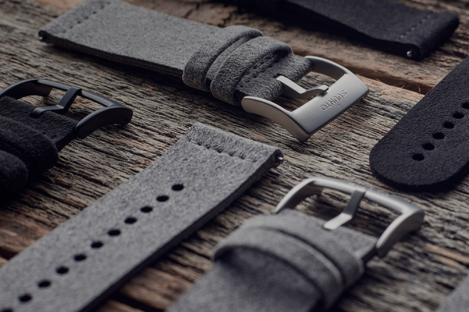


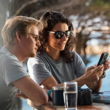


Suunto-blogg
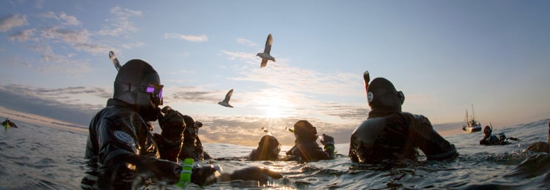

Dive In
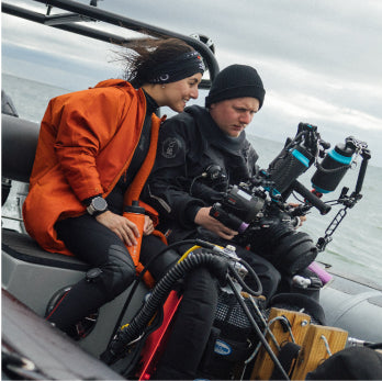
Suunto is proud to present this four part series with pioneering diver and explorer Jill Heinerth taking an in depth looks at the basics of diving physics and physiology to help you better understand your dive computer and plan safer dives.
Suunto Ambassador, pioneering cave diver, explorer and author Jill Heinerth talks about diving physiology in episode one of this four part series.
Can’t wait to watch the episodes? Click the links to dive right in!
Watch Episiode 1 now
Watch Epsiode 2 now
Watch Episode 3 now
Watch Episode 4 now
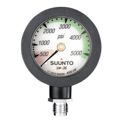
In this episode, Jill Heinerth discusses the basics of dive physics and physiology and how to better use your dive computers as an effective tool when planning, and executing dives.
Talking biological tissue and dive computers, Jill explains how the body reacts to the inert gas you breathe during a dive. When the body is subject to pressure from depth during a dive, it ‘on gasses’ as the inert gas dissolves into your tissues.
Our body tissues include the blood, the brain, ligaments, skin, bone, fat and all your organs and each tissue is delievered different amounts of blood, therefore absorbing different amounts of gas.
The rate in which tissues uptake and release the gas occurs differently for each group of tissues. The groups are sorted into different compartments alongside tissues that have similar gas saturation properties and behave in the same manner.
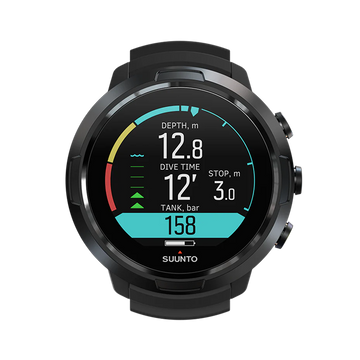
A dive computer allows the diver to view information that assists them on a dive, and the diver has the opportunity to decide to follow the device.
A dive computer will not, for the most, consider the individual differences of each diver using it. The "type" of diver that is considered is an average person, and there is an added safety margin to take into account to accommodate variations.
Your Suunto dive computer is based on mathematical models. This model, or algorithm, calculates the on gassing and off gassing of your compartments. The algorithm implemented at the core of a computer is a simulation of what happens to gases in a diver's body in an environment where pressure changes.
The research and development team at Suunto test, test and test again to ensure they meet the strictest performance targets. The dive team at Suunto are constantly improving and fine tuning the devices by diving with them over and over again, because we know you will too.
Check out episode one now and explore these topics further.
Episode 2
In episode two of Dive In, Jill Heinerth discusses how your dive commuter calculates ascents or decompression stops as we delve deeper into the basics of diving physics and physiology for both recreational divers, and those who dive beyond.
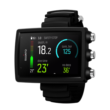
Having discussed how the human body stores and releases inert gas in the last episode, this week Jill examines how your dive computer calculates the maths that work out how the body gets rid of gas during off gassing, and how an ascent is just the beginning of the off-gassing process. Off gassing ends when the body has reached and found equilibrium with the surface.
When the body cannot take on any more gas into solution, it is termed- critical super saturation. This critical moment of reaching maximum pressure is known as the M value.
Different compartments mean lots of M values to consider in order to calculate how the body off gases when ascending during a dive.
Recreational divers will only consider the fast tissues. The time and depth parameters that recreational divers adhere to, keeps them away from nearing critical super saturation point. This is so they may directly ascend to the surface without a decompression stop.
Tech divers load both their fast and slower tissues, and this adds another layer of considerations. Sunnto has a team of dedicated researchers, engineers and testers who are constantly improving algorithms and have much real world dive data to use for their improvements.
Jill dives with Suunto, and says, “I have been diving with Suunto dive computers for over 20 years. Part of this is because I have seen the rigorous testing regiments, I’ve seen the manufacturing standards, as well as their active algorithm research and development. I’ve been to the factory, seen their testing and I know I can rely on their commitment to excellence.”
Find out why decompression models use up to 16 different theoretical tissue compartments and many more hot topics as Jill explains how your computer works in the second episode of Dive In.
Tune in next time for episode 3 to watch Jill get deep with personal factors and gradient factors.
Episode 3
Do you know what your Personal Factors are?
In a world where we are able to choose a product based on what is best suited for our individual needs, why would such a crucial piece of dive equipment, your dive computer, be any different?
Personal factors should not be over looked, yet many divers never read in to the dive computer manual deep enough to understand that their device can be tailored to suit an individual’s need. External influences can be taken into account and the dive computer conservatism setting can factor in risks for each dive. This is a very important part of safer dive planning.
During this episode of Dive In, we look at what the personal factors on a Suunto computer are, and how they need to be applied.
Jill also talks gradient factors, algorithms and dive teams. Few users, or even instructors actually understand how gradient factors work, or what they are. She shines a light on how different decompression models behave, and how dive buddies can work together even if they are diving following different decompression models.
Jill delves into what each number of the gradient factor represent, which one is more important and how to use them in your dive planning.
Jill also looks into the deep stop mystery. As divers we still have a lot of research to do into them, and over the years there has been much conflicting anecdotal advice. There is much misinformation buzzing around social media and dive forums leading to a vast amount of confusion.
Watch now as Jill Heinerth sets us straight on the key issues in this episode of Dive in.
Make sure you tune in next week for the fourth, the final and bonus episode where Jill shares her story of getting hit.
Episode 4
In the final instalment of Dive In, Suunto Ambassador Jill Heinerth discusses her experience of getting ’hit’ with Decompression Sickness (DCS) twenty years ago, what she has since learnt, and how she has adapted her dives to suit her.
Jill was thousands of dives into her career and thought it would never happen to her. DCS, or the bends, is a sports injury and there is a spectrum of how the bubbles can affect your body from a skin rash to paralysis.
In many cases the resulting tissue damage will remain, perhaps increasing the risk of another hit.
Making a few minor changes to her dive since her experience, watch to see how Jill optimises her off gassing phase on a dive and what surprises she has found by doing that little bit extra.
No mathematical algorithm can guarantee your absolute safety, and it is unfair to blame a device if you do get bent. Use your computer to the full and be armed with the knowledge of exactly how it works. Dive computers open up a whole wealth of new underwater adventures, so for one last time, let’s Dive In with Jill.


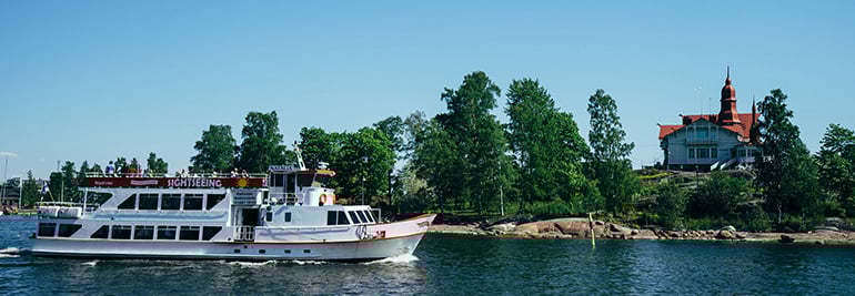
3 must-run routes in Stockholm
This Nordic capital is a pretty fascinating place to visit, and to run. Made up of more than a dozen rugged islands, this city by the sea is both accessible and wild; a splendid combination for those of us wanting to explore her streets and shores by running! Amongst the meandering canals and shorelines, and urban forests, we’ve found some rather memorable runs that will give you a taste of this historic city, which has one of the oldest, and best-maintained city centers in Europe.
While each of these routes is close to the center, each has a natural connection and explores a different part of the city’s archipelago. The first run gives you quintessential shoreline views, the second route, the local haunt, is a park loop that moves you from the city to the forest in mere steps; and finally, a trail-runners dream, the track on Lidingö was seemingly made for exploring.
To follow these routes with your Suunto watch or mobile device, please follow these instructions:
1. Press download GPX.2. Go to Suunto app and press + button in app map and press 'import route'.3. Find the route, press it. The app opens the route, press 'Done'.4. You can modify name and details. The route is saved. Keep the 'Use in Watch' toggle on to have the route in watch.
Note: If you are not reading this on a device with Suunto app installed, download the route file and save it in a location you can access on your mobile device. Then follow the guidance above.
Trails, Cobbles and Castles (6,7 km)
Download the GPX file here.
Description:
The perfect morning walk or run. Start at the public swimming pool (Eriksdalsbadet) and follow the Södermalm waterfront, cross the canal at the first bridge, and when you arrive on the other side, you’ll be immersed in the beautiful Årsta forest. Here you’ll get a little climb, and earn the best city view from the south. Follow the loop back across the next bridge ahead of you and back to your starting point.
Despite the great location, generally the route is never packed, and the track is mostly paved and suitable for walkers and runners. Try to get out here early in morning for a beautiful, crisp start to your day!
Starting Point Note:
The Public swimming pool is accessible from the train (Skanstull Station) and is walking distance from anywhere in Södermalm.
Finishing Point Note:
When you are done, you’ll want to re-fuel, and if that includes coffee, you’re in the right place, follow Swedenborgsgatan to #7, there you’ll find a brilliant little cafe called Johan & Nyström, which is home to great coffee and they’re open at 07:00 (M-F) so they’re ready for you even if it’s an early run.
Djurgården (8,9 km)
Download the GPX file here.
Translated as ‘animals garden,’ Djurgården is a stunning city park that branches off from the old town in the centre of Stockholm and provides an invigorating 10km loop. Starting at the King’s Garden (Kungsträdgården), run along the harbour via Strandvägen, then right over the bridge and into the park.
The route passes by the amusement park, Gröna Lund, and the popular Nordic Museum. There will almost always be some locals on the trails, but never too many. There isn’t too much climb and the trails are broad and well-maintained. Keep to outermost path until Manillavägen where you’ll cross to the other side of the island and make your back to the bridge, then to King’s Garden.
Starting/Finishing Point Note:
King’s Garden is a brilliant place to finish as its beautiful grounds, and numerous outdoor cafes are a welcome sight after a brisk 10 km.
Lidingö – A run on the wild side (29,9 km)
Download the GPX file here.
Description:
This is the spot for a trail run. Lidingö is an island with a full network of trails for running adventures from 4 km to 30 km. It is only minutes from the center of the city, and is home to the most popular trail running events in Stockholm, including the Lidingöloppet, the world’s largest trail race! The race, which began in 1965 with 644 runners is now more than 24,000 runners strong!
The route is full of hills regardless of the distance, including the famous and gruelling ‘Abborbacken hill’ which climbs 46 m in elevation within 550 m. Throughout Lidingö there are stunning views of the city, the sea and the surrounding bays. The final 10km of the full loop is lit, so you can even run this portion at night!
Starting Point Note:
You can get to Lidingö from Gamla Stan via the #13 train to Ropsten, then take bus 203/204/211 to Lidingövallen (Lidingö City stadium).
Alternatives & POIs:
For a shorter variation (22 km) you can skip the first 8km and start from Lidingövallen and head eastwards, this includes the final 10 km known as “sista milen.” In the summer, grab a coffee at the charming, Kaptensstugan, at Klubbvägen 2 which is right along the trail (we’ve marked it as a Cafe POI on the route).
Finishing Point Note:
Based on the full trail (30 km) or the last 10 km, it is the same Lidingöloppet finish. From here you can walk along Grönsvagäden (south towards the nearby Kyrkviken or ‘Church Bay’) to Lidingövallen (Lidingo City stadium - Kyrkvägen 56). Here you can get changed and have a shower after your adventurous run (M-F 10:00-19:00).
From here (Lidingövallen) grab a 203/204/211 bus to the Ropsten stop + #13 train back to Gamla Stan / city centre.
Discover new routes with heatmaps. Heatmaps show the tracks frequently used by the Suunto App community all over the globe, based on millions of moves. You can plan your own route with the help of rich, topographic maps, transfer it to your compatible Suunto watch and start exploring.
With Suunto 5 and Suunto 9 watches, you can add these routes directly to your device and track your progress.
Main image: Tony Moran/Shutterstock.com
SEE ALSO MUST-RUN ROUTES IN BARCELONA, HELSINKI, LONDON, NEW YORK CITY AND PARIS


3 must-run routes in Barcelona
One of the most memorable and hospitable cities to run in, Barcelona’s streets, parks and trails are as welcoming as her inhabitants. While Barcelona is the largest city on the Mediterranean Sea, it is also an intimate and intricate place with subtle beauty that seems to mix perfectly with its more audacious architecture.
To see Gaudi’s masterpiece, the fantastical Sagrada Família in person is one thing, but to gain a sense of the city by running amongst her streets and people is something that won’t fail to leave a lasting impression. We’ve found you three unforgettable runs in Barcelona; a short, wondrous route, a path that will want to make you want to become a local, and finally a trail with some climb, some wildness and some views! These runs are experiences of discovery, now all you have to do is choose one!
To follow these routes with your Suunto watch or mobile device, please follow these instructions:
1. Press download GPX.2. Go to Suunto app and press + button in app map and press 'import route'.3. Find the route, press it. The app opens the route, press 'Done'.4. You can modify name and details. The route is saved. Keep the 'Use in Watch' toggle on to have the route in watch.
Note: If you are not reading this on a device with Suunto app installed, download the route file and save it in a location you can access on your mobile device. Then follow the guidance above.
VISUAL WONDERS (5,0 KM)
Download the GPX file here.
Description:
Up for some visual wonders? We hope so! You are now in the heart of the city. Follow Passeig de Gracia from the Metro station, warm up slow as you’ll begin to be spoiled with sights. Turn right on Av. Diagonal until Carrer de Provença, follow this until you see the Sagrada Família. We understand if you just want to take a few moments (or hours) here, the surrounding parks provide a brilliant perspective to Gaudi’s masterpiece. You can loop around behind it and back along Carrer de Mallorca. Left towards the sea at Passeig de Sant Joan, and straight to the Arc de Triomf. Boom! You’re done! (Hopefully you didn’t miss La Pedrera, Casa Batlló, Casa de les Puntxes!)
Starting Point Note:
This route is easily accessed by Metro as it starts at the Passeig de Gracia station. Begin northwest (away from the sea).
Finishing Point Note:
Your end point is the Arc de Triomf, sublime. Your après-run is well-situated, continue past the arc to the Parc de la Ciutadella. Its beautiful grounds and fountains are the perfect place to relax, do some stretching, and wonder amongst the sculptures and monuments. Also, if you happen to be into comics, a block before the end of the route, along the Passeig Sant Joan @ Carrer Ali Bei, you’ll find a number of shops dedicated only to comics. Grab a coffee and enjoy!
BARCELONA BEACH RUN (9,0 KM)
Download the GPX file here.
Description:
This is truly the local’s route, Barcelona Beach is one of best you’ll see in a city anywhere in the world. This track is well-lit, safe and runnable throughout the year. It can get busy (because it's beautiful) with non-runners in the afternoon, especially in summer so get out there early in the morning to have your path, and your view of the Mediterranean Sea, clear.
The route is an out and back, running parallel to the shoreline, the track is smooth, flat and fast. With an invigorating breeze off the sea, you might be inclined to do some impromptu tempo work. The turn-around is at El Parc del Forum, the city’s most popular spot for outdoor concerts and events. As you’re headed back, run a little past your starting point and you’ll find that this straight-forward run has a sweet ending. You’ll see a main-stay of the beach’s skyline, “the Sail” as the locals call it (W Hotel Barcelona). You are now in one of the most fascinating parts of the city, La Barceloneta, a neighbourhood which was first inhabited by solely by fisherman, is today full of renewed energy and home to countless restaurants and charming little bars.
Starting Point Note:
Taking the Metro to Cuitadella/Vila Olimpica station will place you within a block of the track (Av. del Litoral) which runs along Barcelona Beach (Passeig Maritim del Port Olimpic). You can begin your route anywhere along this path, but we’ve started near Parc del Port Olimpic, so head left as you walk from the Metro station.
Finishing Point Note/Alternative:
On the route we’ve shown you how to return to the start after a short visit of La Barceloneta, another option is to end here, as it is home to all sorts of activities, entertainment and fun you can find rentals for SUP, and the best paella in town, head to Kaiku (Placa del Mar 1, open for lunch and dinner), then stroll back to the start/finish.
EL TIBIDABO (13,2 KM)
Download the GPX file here.
Description:
Now you’re in for a treat. While the other routes were in the heart of the city, this one will make you earn the best views of the city! This route climbs to the top of el Tibidabo (512 m), starting from a famous trail called "Carretera de les Aigues" – this is also the name of the train station (FGC not Metro) that will bring you to the starting point from the city centre in only 15 minutes. The path starts as gravel and some pavement, and eases you into the run with the first 3–4 km relatively flat. Then you climb. The part of the trail that goes up and and down the mountain is in a loop. Syncing this route and tracking your progress on your Suunto GPS watch is important as the twists and turns are significant.
At the top you’ll find one of the oldest amusement parks in the world, with a classic old ferris wheel and carousel, as well as the beautiful Sacred Heart church. The best views of the city and the sea are from here, whether you’re on of the rides or not. If your quads want to stop here, its possible to have a meal a catch a bus back down, then grab a train back to the centre.
Run during the week for the smallest crowds on the trails and at the top!
Starting Point Note:
Take an FGC (schedules at fgc.cat) train from the centre (Catalunya Station) to the Carretera de les Aigues stop. The trail begins immediately from there heading east (or left as you face the sea). It is generally safe to run at all hours, but if you’re going out early in the morning or later in the evening, bring a headlamp with you as it will be dark on the trails.
Finishing Point Note:
Your finish is at Av. Tibidabo (@Paaseig de la Bonanova). The train can take you right back to Catalunya Station.
Discover new routes with heatmaps. Heatmaps show the tracks frequently used by the Suunto App community all over the globe, based on millions of moves. You can plan your own route with the help of rich, topographic maps, transfer it to your compatible Suunto watch and start exploring.
With Suunto 5 and Suunto 9 watches, you can add these routes directly to your device and track your progress.
Main image: © Senai Aksoi/Shutterstock.com
SEE ALSO MUST-RUN ROUTES IN HELSINKI, LONDON, NEW YORK CITY, PARIS AND STOCKHOLM


3 must-run routes in Paris
Paris. The City of Light could also be known as a runner’s delight! It is a feast for the senses, it’s true, but there’s also a special view of Paris known only by those who run her cobbled streets and pristine parks in the early morning, or twilight hours. We’ve added some rich detail to each of these routes, not only about the route, but the character of the surroundings. After all, it’s not just about where you run, but also what makes it truly memorable.
In Paris, all runs are scenic, so we’ll just take that as a given; but each of these, beginning with a short, walkable route, to a local's run that will show you a perspective of Paris will make you believe you were made to run here. To finish, we’ve included a little adventure off the beaten track. Each run has a distinctive personality and quirks, full with their own highlights and history, you won’t want to miss adding any of them on your must-run list.
To follow these routes with your Suunto watch or mobile device, please follow these instructions:
1. Press download GPX.2. Go to Suunto app and press + button in app map and press 'import route'.3. Find the route, press it. The app opens the route, press 'Done'.4. You can modify name and details. The route is saved. Keep the 'Use in Watch' toggle on to have the route in watch.
Note: If you are not reading this on a device with Suunto app installed, download the route file and save it in a location you can access on your mobile device. Then follow the guidance above.
Run, walk & chill (4,9 km)
Download the GPX file here.
Who is it for
Tourist run/walk jammed to the rim with spectacular sights and culture.
Description
Beginning at the Boulevard de la Bastille, you’ll enjoy having space to run and probably have a chance to see some local Parisians playing the famous French sport of Pétanque. As you follow the boulevard towards the right, you’ll see notice a beautiful harbour, Port de l’Arsenal. You’ll arrive at the Seine at Quai de la Rapée metro station, cross here by the bridge and you’ll be in front the entrance of Jardin des Plantes, one of the most beautiful public gardens in Paris. Its worth a lap, if you like gorgeous things.
A special tip: on the right side of the garden, there is a zoo hidden to the crowd. It’s definitely worth a peak.
Once you’ve finished your lap(s), leave by the main entrance and proceed left. Crossing the street, you’ll be back at the banks of the Seine. This is one of the best spots to experience Paris in the summer, always packed people and full of atmosphere. You’ll run into (not literally, hopefully) Parisians dancing, enjoying some Aperitif, and playing music. Cross the next bridge you see and the Boulevard Henri IV will bring you back straight to Bastille.
Starting Point Note
If you are taking the Metro, the station is “Place de la Bastille.” If you are staying in Le Marais, you can use the 5 minute walk east along Rue de Rivoli/Rue Saint-Antoine as a warm up.
Finishing Point Note
For an enjoyable recovery, stop at the Café de la Presse, and have a coffee on the terrace. Its located perfectly at you start/finish point: 36 Boulevard de la Bastille. If you’re walking back West, Places des Vosges is mere blocks away (the oldest planned square in the city, and one of the most beautiful).
Alternatives/extensions
When you’re leaving the Jardin des Plantes, keep running to the left until the 4th bridge. You’ll arrive on the Île de la Cité, and at the Notre Dame de Paris. It is always busy around here, so be prepared. Then follow Rue de la Cité and Port Notre Dame until you see Hotel de Ville, Paris City Hall. Run straight to the Port de l’Arsenal and finish strong back to the Bastille.
Canal Saint-Martin (8,7 km)
Download the GPX file here.
Who is it for
Runner’s looking for the go-to route from those ‘in-the-know.’
Description
Easy run, Tempo or Fartlek- whatever you’re up for will work here. The are wide lanes, few turns, and no cars; its all you (and your legs. Follow the Canal Saint-Martin and Canal de l’Ourcq until the Parc de la Villette. Then come back by the other side. You’ll see runners passing, and pushing intervals. The best time to run here is on Sundays as the road is fully closed to cars. The atmosphere is very cool all along the route. While it’s the best path along through the 10th, 11th and 19th arrondissements, its generally only locals you’ll see running here.
Starting Point note
The Metro Station Republique is a couple blocks southwest from you starting point, which is the northern tip of Le Marais and easily accessible from/to many parts of the city.
Finish Point note
As a happy ending, stop for brunch at American Bistro, located at 75 rue de la Folie Mericourt in Oberkampf. It’s very close from the finish line run and it’s delicious.
Extensions/Alternatives
If your legs are still up to it, after the Canal, you can turn right when you pass by Rue Louis Blanc, then follow Avenue Mathurin Moreau until Parc des Buttes Chaumont. You won’t be disappointed as the park is just stunning, full of unexpected wonder. It’s a big park with a good amount of runners and… a lot of hills. You’ll definitely earn your time here; the good news is, it’s great training for that upcoming race!
Bois de Boulogne (16,3 km)
Download the GPX file here.
Who is it for
Runners wanting quiet and green.
Description
This urban-trail run takes you to the Bois de Boulogne, the most popular location for Parisians runners getting in their long training runs. This is also the end of Paris Marathon so lot of runners prepare for the big race here. Sunday mornings are pretty cool as locals and visitors are running with dream marathon finishes in their mind.
From the Arc de Triomphe, take Avenue Foch for one kilometre (west). The path veers to the right and arrives at one of the entrances to the ‘forest.’ Following that direction, you’ll come across a pair of small lakes. A common loop is to circle these lakes, building tempo, but you can also go further in the woods. On your way back, we recommend you run back along Avenue Foch, past the Arc de Triomphe and down the Promenade des Champs-Élysées.
Starting Point Note
Arc de Triomphe, the Metro station is “Charles de Gaulle Étoile” and trains in every direction connect here (1,2,6).
Finishing Point Note
Finally stop at Place de la Concorde, you are now in the beautiful heart of Paris; just steps from the Jardin des Tuileries and Musée du Louvre. Metro stations “Louvre-Rivoli” and “Palais-Royale-Musée du Louvre” to take you where you need to go (should you even want to leave!).
Discover new routes with heatmaps. Heatmaps show the tracks frequently used by the Suunto App community all over the globe, based on millions of moves. You can plan your own route with the help of rich, topographic maps, transfer it to your compatible Suunto watch and start exploring.
With Suunto 5 and Suunto 9 watches, you can add these routes directly to your device and track your progress.
See also must-run routes in Barcelona, Helsinki, London, New York City and Stockholm


3 must-run routes in New York City
New York City. It can be daunting to figure what to do and where to go when visiting New York City, especially on a tight schedule, this includes fitting in a run. We understand and have done the scouting and compiled your go-to route guide to running in the city on a timeline.
Whether you are looking for a sight-seeing route in Central Park, a local favourite track along the shoreline that makes up Hudson River Park, or a long run/urban adventure into Brooklyn we’ve got the routes to give you that runner’s high in the Big Apple. This list is focused on Manhattan, though the final route does make a brief and memorable stop in Brooklyn.
To follow these routes with your Suunto watch or mobile device, please follow these instructions:
1. Press download GPX.2. Go to Suunto app and press + button in app map and press 'import route'.3. Find the route, press it. The app opens the route, press 'Done'.4. You can modify name and details. The route is saved. Keep the 'Use in Watch' toggle on to have the route in watch.
Note: If you are not reading this on a device with Suunto app installed, download the route file and save it in a location you can access on your mobile device. Then follow the guidance above.
In the middle of it all: Central Park (2,9–9,8 km)
Download the GPX file here.
Who is it for:
Tourist run/walk route, you could say a wonder overload!
Description:
Central Park is the quintessential running track in Manhattan. It is the home of the NYC Marathon finish line, countless events throughout the year and countless options for short or long loops. There is an energy in the park that is unique, people from all walks of life, tourists and elite runners; everyone runs here and the park is almost always busy, but rarely crowded, especially at the northern end.
Most running groups, clubs and organizations meet at Columbus Circle and head off together, generally moving counter-clockwise around the park. Our route starts here as well. As you begin, you head east, some of the most recognizable skyline immediately becomes visible. You’re now on the route of the NYC marathon (though in the opposite direction). As you track left on to Terrace Dr., you’ll pass Bethesda Fountain and Strawberry Fields before making your way back towards your starting point, watch out on your right for the famous Tavern on the Green.
Starting Point Note:
Columbus Circle is the corner 59th Street & 8th Ave and is reachable simplest via train (A, B, C, D, 1). When you are on the southern half of the park, it’s like having aid stations, as vendors lining the main route have stands where they sell water and gatorade, which comes in handy on those hot summer days, so bring a couple bucks, there are also a handful of water fountains.
An excellent time to run is when the park is closed to traffic, Monday through Friday from 10AM-3PM and 7PM-10PM and also on the weekends starting at 7PM on Friday through 6AM on Monday. If you can't fit in a run during these times, a runner's lane (the innermost recreation lane) is always available. It is recommended, for safety reasons, that you run against the traffic.
Finishing Point Note:
Typically ending at Columbus Circle provides the best end-point and access to transportation, and other amenities, including a Whole Foods in the lower floor of the mall, with its own pub, perfect for post-run refreshment and snacks!
Possible route extensions and alternatives:
Central Park provides countless different routes through it’s beautiful grounds, with different sights and appeals for the runner, you really can’t go wrong. There is a main route (paved road) that is the most popular, as well as multiple transverses that cut across the park, providing more options. Paths and trails also criss-cross the park, leading to sights including The MET, the Reservoir, and the Central Park Zoo.
The Reservoir Loop:
This route gives runners a soft surface cinder path about 3km around the Jacqueline Kennedy Onassis Reservoir. It is a mostly flat track and offers incredible views of the city, particularly picturesque at sunset. Try to remain on the right side of the path and run counterclockwise. This route is best accessed by taking the train to 86th Station (A,B,C trains) and following 85th St Transverse or paths to the reservoir.
Full Loop:
For the full experience (and the biggest hills) follow the main paved road throughout the park. The full loop measures just under 10km, and will give your legs a good work out.
Locals Route: Hudson River Park (6,3 km)
Download the GPX file here.
Who it is for:
For runners looking for a speedy shoreline and abundant attractions.
Description:
Hudson River Park is the longest waterfront park in the US. While part of the attraction to this path is the shoreline of the Hudson river, in recent years, significant development has taken place making the run more pleasant, and more interesting. It is hard to beat the crisp morning miles with the sun peacefully rising over the bustling city, peaking through the towers, but there really isn’t a bad time to enjoy this route. With runners able to jump into the path anywhere along the length of Manhattan, it is also easy to meet up with others or adjust your distance should you like to. The path is flat, and heads downtown to the tip of Manhattan, Battery Park. From here you have a nice vantage point to the Statue of Liberty.
In true NYC fashion, you can also find a myriad of activities to go along with your run including kayaking, beach volleyball, golf driving ranges, ice skating, Chelsea Brewing Company, outrigger canoeing and even sailing lessons!
Starting point note:
We have built this route to deliver the most interesting sights in a short distance. Beginning at Chelsea Piers, an activity and amenity hub and an attraction in and of itself. 23rd St has Subway stations at 7th Ave & 8th Ave with trains coming from all over Manhattan, from those stations head west (larger Avenue #s)
Finishing point note:
When you’re done, Table Green in Battery Park (open seasonally) offers a full compliment of beverages and snacks in the beautiful Bosque Gardens. To return to the start of the route, walk north to Rector St and jump on the Uptown 1 to 23rd St and this will put you back in Chelsea, a few blocks east of where the route began. Lower Manhattan has efficient train access to all parts of the island.
Possible route extensions and alternatives:
A nice cool down route, is to follow the High-line which runs parallel to the park and is particularly close to the route from the neighbourhood of Tribeca to 23rd St. Join it from Gansevoort St & Washington St and enjoy the stroll uptown passing the Chelsea Market (@ 15th St.).
Should you want to run longer, start further uptown; at the Intrepid Sea, Air & Space Museum (46th St and 12th Ave) and run downtown towards Battery Park. Or even start at Battery Park and run all the way to the George Washington Bridge and the “Little Red Lighthouse” (20km).
Adventure Run: Mid-town to Brooklyn (14,6 km)
Download the GPX file here.
Who is this for:
Runners looking for some urban adventure on their run.
Description:
Sunday morning long run in NYC? Want to walk out the front door and go? Here’s a route for you! Starting in mid-town, at Herald Square, you’ll pass the Empire State building, run along the East River, crossing over the Iconic Brooklyn Bridge, take a loop quick through DUMBO, pause near Jane’s Carousel for a view with BK bridge and the Manhattan skyline together. Plenty of visual inspiration to keep you moving!
Running in mid-town is only really advisable in the early mornings and preferably on the weekends. Sidewalks are characteristically uneven and unpredictable, so keep aware of where your feet are falling, with the usual pedestrian traffic, this becomes difficult to navigate safely and to enjoy a good flow to your run.
Starting point note:
Herald Square (34th St and Broadway) is always busy, full cafes, shops (including the largest in the world - Macy’s - in case you forgot your runners). Most subway lines stop here within in a block or two. Begin by heading east (towards smaller avenues) and you’ll pass the Empire State building. When you hit the East River, turn right (downtown).
Finishing point note:
Brooklyn Bridge Park, end at Grimaldi’s Pizza, or the Shake Shack next door and re-fuel, then jump on the East River Ferry half a block away and enjoy the view of Manhattan on your left and Brooklyn on your right ($4 on weekdays/$6 on weekends), the boat will drop you back at 34th St, head across town and you’ll find yourself back at Herald Square.
Discover new routes with heatmaps. Heatmaps show the tracks frequently used by the Suunto App community all over the globe, based on millions of moves. You can plan your own route with the help of rich, topographic maps, transfer it to your compatible Suunto watch and start exploring.
With Suunto 5 and Suunto 9 watches, you can add these routes directly to your device and track your progress.
Lead image: Photo by Becky Phan on Unsplash
SEE ALSO MUST-RUN ROUTES IN BARCELONA, HELSINKI, LONDON, PARIS AND STOCKHOLM

3 must-run routes in Helsinki
We know the desire to run does not stop when you travel, in fact many times its the opposite. Running is one of the best ways to explore a new city! One of the challenges to fully enjoying this potential is not knowing where to go. Big cities have lots of sights and routes, but how to find the right one? We’ve got you covered! Here at Suunto, we’ve put together a collection of routes that showcase some of the best parts of Helsinki (our hometown!).
Through winding parks in the heart of the city, to historic sites and architecture, these routes hit all the high notes. We’ve put together three main options for you; short and scenic route, a favourite track of local runners and those “in-the-know,” and finally an adventurous trail in the city’s Central Park, winding through the heart of Helsinki. Trust us, you’ll be thankful you brought your sneakers!
To follow these routes with your Suunto watch or mobile device, please follow these instructions:
1. Press download GPX.2. Go to Suunto app and press + button in app map and press 'import route'.3. Find the route, press it. The app opens the route, press 'Done'.4. You can modify name and details. The route is saved. Keep the 'Use in Watch' toggle on to have the route in watch.
Note: If you are not reading this on a device with Suunto app installed, download the route file and save it in a location you can access on your mobile device. Then follow the guidance above.
Short, sweet and central – Töölönlahti (4,9 km)
Download the GPX file here.
Who it is for:
Tourist run/walk route taking stunning views of the city in less than 5 km.
Description:
Töölönlahti is the most popular and frequented of any running loop in Helsinki. It is peaceful, picturesque and in the heart of central Helsinki. The track follows the shoreline of a charming inlet, that in the span of just over 2 km lends views to Finlandia Hall, the Opera House and the tower of the Olympic Stadium.
Particularly scenic are the calm, early morning hours as the still water of the bay, and finishing up in time for a coffee and snack at one of the many quaint cafes nearby. Most afternoons see many visitors, though even when it's busy, it's not crowded.
Start point note and logistics:
From the Central Railway Station exit west (right as you leave the main exit). You’ll walk past the Kiasma contemporary Art Gallery, The Helsinki Music Centre and Finlandia Hall, and you’ll see the bay from there. The route follows the water to the right! Have fun!
Finish Point note + post-run POIs
The most straightforward point to finish at where you began but there are countless options to exit the loop, you can head towards the Olympic Stadium for a visit, or to a charming little cafe overlooking the bay Cafe Sininen Huvila (summer only).
Run extensions and alternatives:
On the opposite side of the bay from the starting point, is a small foot-bridge that takes you over the train tracks to the opposite side of the bay. You can follow this extension of the route for an additional 2.5 km of mostly flat shale, and paved path. Your tree-lined route includes turn of the century, stone buildings to keep you company, here you’ll find a go-to pub and patio called Juttutupa should you need refreshment. The loop circles back to the same foot-bridge, so you’re never too far from you started.
Locals Run – Sibelius Seaside (7,9 km)
Download the GPX file here.
Who it is for:
The locals running route: Some history and some wild & rugged island terrain, a feast for the senses and the legs!
Description:
The route begins at the Sibelius Monument, an ode to Finland’s greatest composer, Jean Sibelius. This handsome park can be busy at times with visitors and tour buses, but as you head towards and along the seaside, you will find a new view of wild coast-line of Helsinki. The charming island of Seurasaari, a frequented haunt for Helsinki’s runners of all abilities. This teardrop-shaped island is home to undulating trails woven amongst lightly-wooded, rocky terrain, seemingly dangling in to the Baltic Sea. An open-air museum that displays traditional Finnish way of life and homes from the past four hundred years is a fascinating distraction along the way.
Start point note and logistics:
The Sibelius Monument is 2.5 km from the Central Railway Station. The best (and most fun) way to get there is to take the tram. Firstly, head west from the train station to Lasipalatsi (on Mannerheimentie). You can take Tram #4, 7A or 10 that head west, away from the city centre. In four stops you’re at Töölön Kisahalli, get off here and head towards the sea along Humalistonkatu, and you’ll find the park.
Finish Point note and post-run POIs:
Your route back follows your outbound journey and ends at the beloved Cafe Regatta, across the road from your starting point. If you still have some energy, you can also extend your outing with some kayaking or SUP, which you can rent directly from the cafe (open year-round).
Run extensions and alternatives:
Instead of finishing at Cafe Regatta, you can continue back along the water for a dip in the Baltic Sea at Helsinki's largest beach, Hietaniemi (1.5 km further), or turn left towards the centre at Hesperian Esplanadi.
Adventure Trail – Paloheinä & Helsinki Central Park (18,4 km)
Download the GPX file here.
Who it is for:
The trail and forest adventure-seeker.
Description:
The first 7 km is a loop around the Paloheinä forest. There are a multitude of off-shoots in the forest with a mix of single-track and main trails, in the forest you’ll be able to get a nice mix of elevation change and some reasonably technical portions. Around the forest is a mostly flat, mixed gravel trail.
When heading to the city through central park the route is pedestrian roads (gravel sur-face) and there are many different paths that can be taken, you can use your Suunto watch (Suunto 5, or Suunto 9) to track your progress on the trail running heatmap. This narrow shard of greenery through the city will make you feel as though your entirely away from the bustle.
Start point note and logistics:
Straightforward to get to. Take the 66 or 66A bus from the Central Railway Station, and it is the last stop on the route. Conveniently there are free showers and dressing rooms in Paloheinä should you want to spend your entire time running the forest. Open in the summer Mo-Fr 12-21, Sa-Su 10-18.
Finish Point note:
We have plotted the route to pass a little bay called Töölönlahti (also mentioned in the first route), so anywhere in this area you’re in close proximity to hotels, cafes and a veritable plethora of points of interest.
Run extensions and alternatives:
You can spend as long as you like in the forest, sometimes the single-track is too fun to leave! Even if you get lost the park it’s not too big that you can’t find you way out soon enough. There is a main trail within the forest which is used for cross-country skiing in the winter and covered with soft blanket of sawdust. It’s easy to spend a couple invigorating hours within this quiet, natural space, and you can always take the 66/66A bus back to the centre.
Discover new routes with heatmaps. Heatmaps show the tracks frequently used by the Suunto App community all over the globe, based on millions of moves. You can plan your own route with the help of rich, topographic maps, transfer it to your compatible Suunto watch and start exploring.
With Suunto 5 and Suunto 9 watches, you can add these routes directly to your device and track your progress.
Lead image: Photo by Markus Winkler on Unsplash
SEE ALSO MUST-RUN ROUTES IN BARCELONA, LONDON, NEW YORK CITY, PARIS AND STOCKHOLM